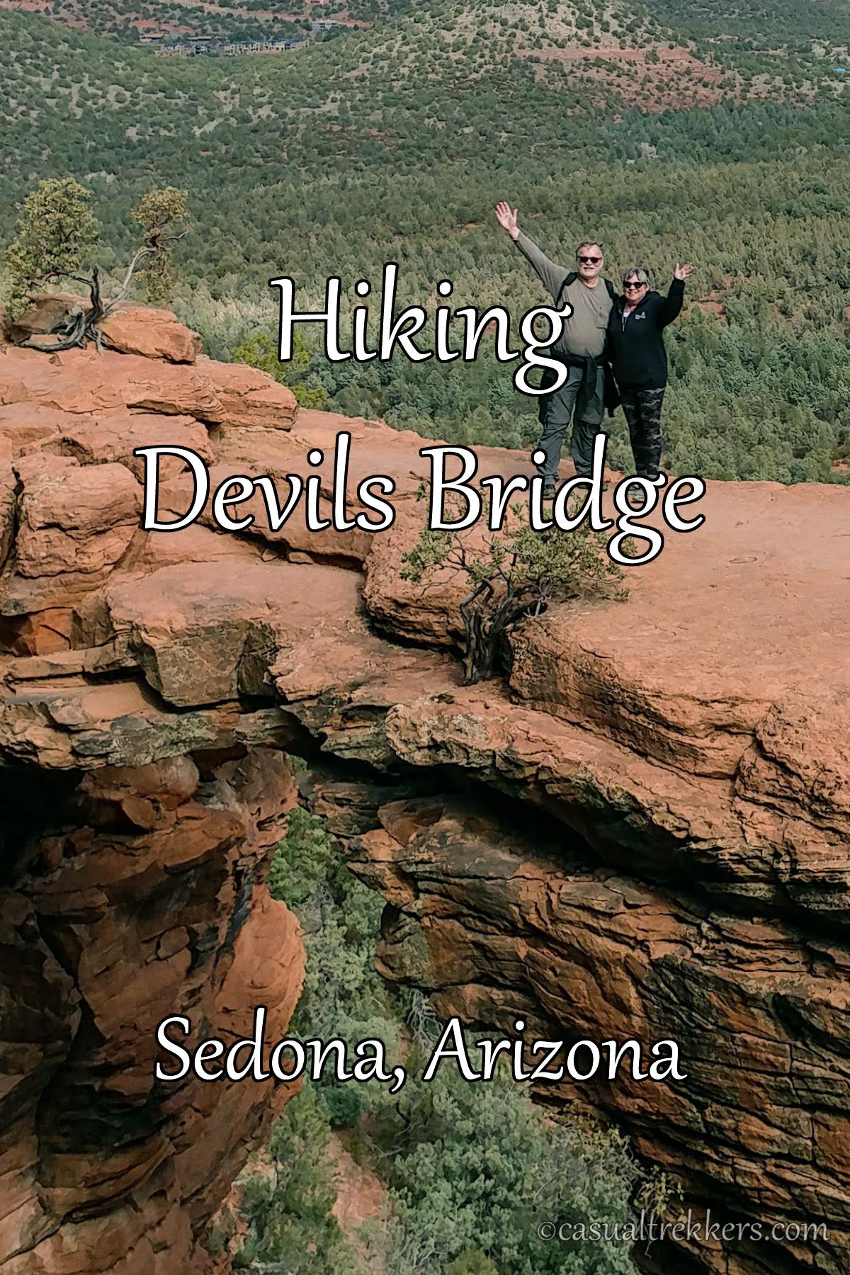
Devil’s Bridge Hike:
There are a few different options to hike to Devil’s Bridge.
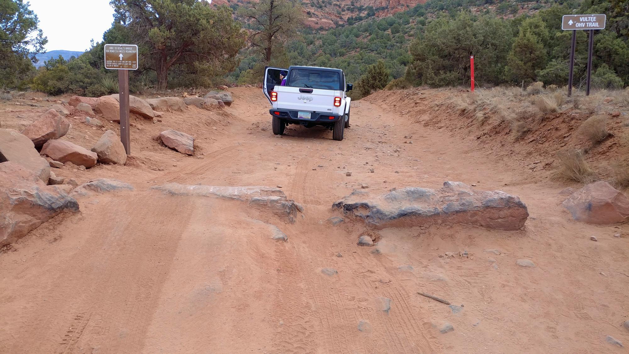
Option 1: The shortest route requires a high profile 4×4 vehicle and driving up Dry Creek Road to the Devil’s Bridge Trailhead. We had a rental and were looking forward to the shorter hike since we were in a Jeep Cherokee, however we quickly changed our minds when we pulled up to cross the first obstacle!. Once we abandoned that option we quickly headed to the parking lot at the Dry Creek Vista trailhead to snag a spot. If you are capable of making your way down Dry Creek Road to the small dirt lot your hike will be a 2 mile round trip.
Options 2 & 3: Both start from the Dry Creek Vista Trailhead parking lot, or in our case an additional 1/4 mile up the road. From this point there are a couple routes to choose from.
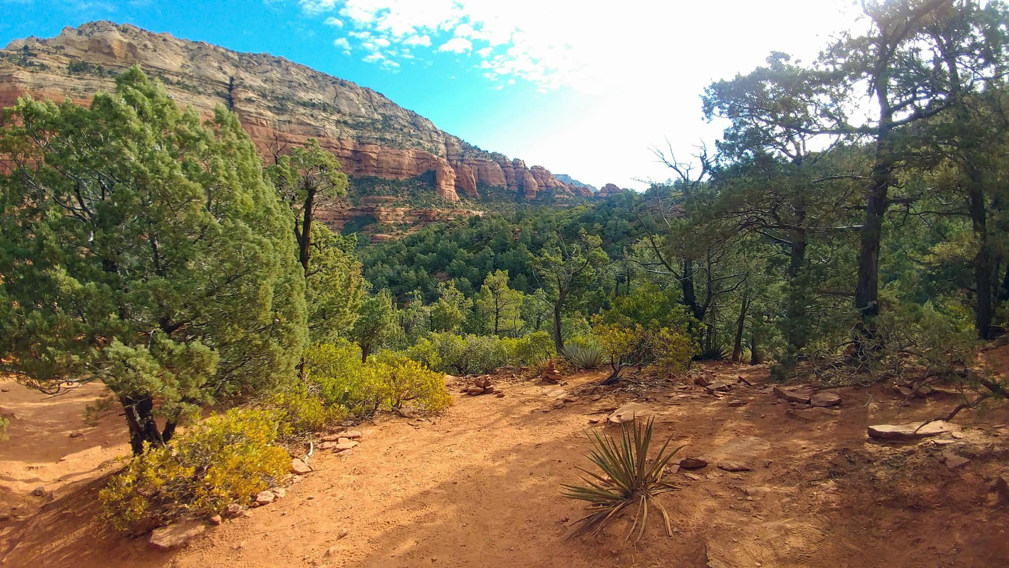
Option 2: The most popular and easiest route from the parking lot is to walk up Dry Creek Road for just over a 1 mile to the beginning of the Devil’s Bridge Trail. This is where you find a small dirt lot where the 4×4’s park for the remaining portion of the hike. Understand that Dry Creek Road is a dusty and bumpy road and that you will be sharing the road with 4×4’s and Sedona’s Pink Jeep Tours that tend to kick up quite a bit of dust, so be prepared for plenty of dust going this route. Hiking up Dry Creek Road makes the round trip hike 4.2 miles. This is the route we chose.
Option 3: Another option from the same parking lot is to hike the Chuckwagon Trail to the Mescal Trail until finally connecting with the Devil’s Bridge Trail. This option provides some great views of the surrounding red rock area as it meanders through a more lush area compared to dusty Dry Creek Road. This route is approx. 5.8 miles round trip.
Option 4: Starting at the Mescal Trailhead is another option available which makes the hike 4 miles in length round trip. You’ll hike the Mescal Trail until you intersect with the Mescal-Chuckwagon trail
If you are unsure if your 4×4 is capable of maneuvering down Dry Creek Road, you can take a look at the Jeep in this photo. While it made it past the first obstacle you can see the driver getting out to survey any damage from bottoming out in the process!
Arrive Early:
You probably already discovered that popular hiking destinations require an early arrival to beat the crowds. Starting out from Phoenix that morning we found ourselves a little disappointed upon arriving and finding the parking lot completely full at 7:00 am. We proceeded to find a relatively close roadside spot along Boynton Pass Rd which was already beginning to fill up, this added about 1/2 mile to our hike up Dry Creek Road.
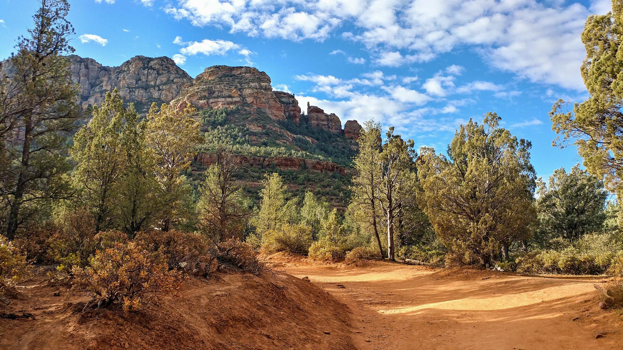
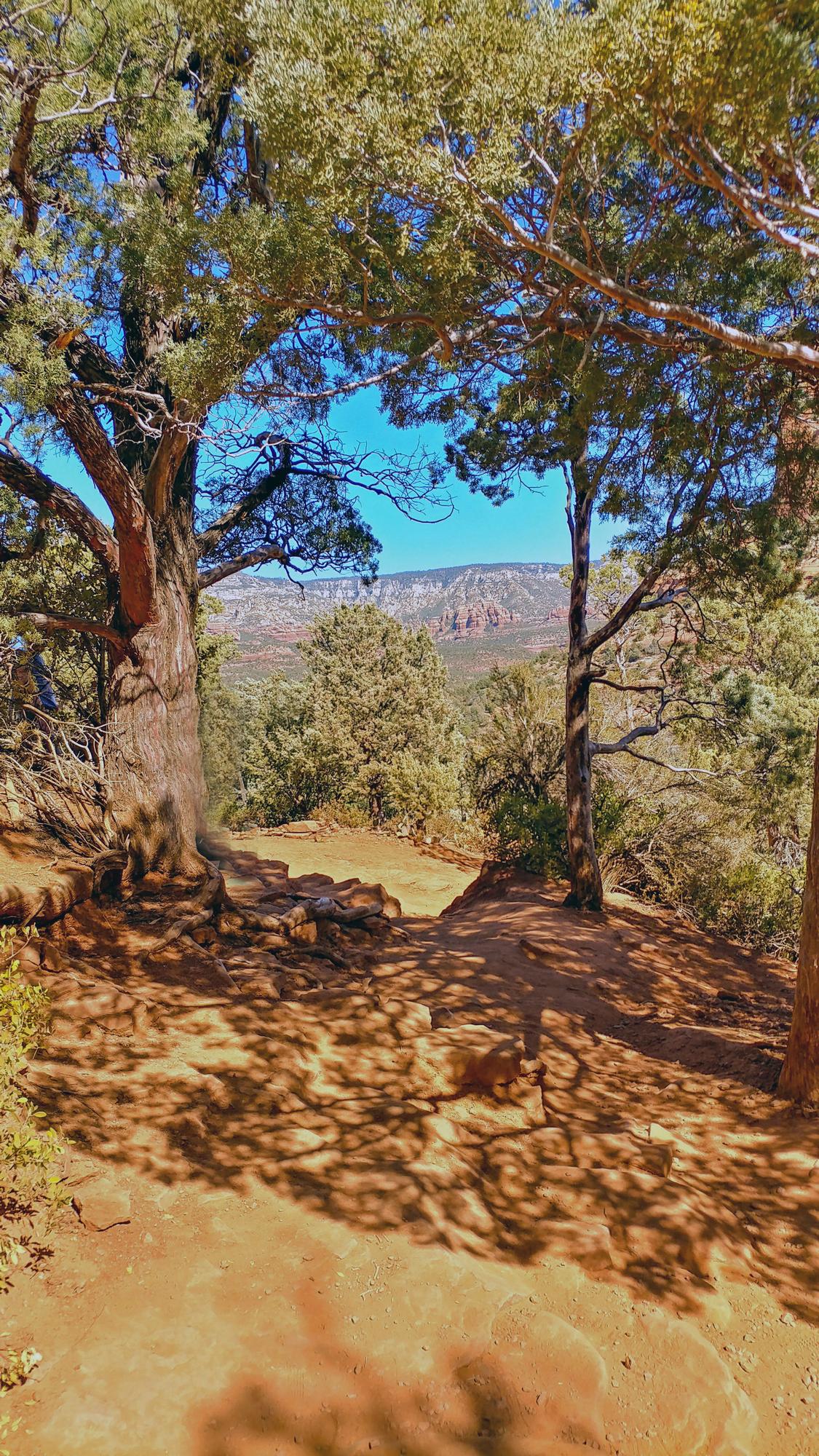
We chose option 1, the most popular route, and walked up Dry Creek Road for just over a 1 mile from the parking lot to the beginning of the official Devil’s Bridge Trail. The road runs alongside Capitol Butte and provides some beautiful views so be sure to take them in as you make your way. As mentioned you do share this road with off road vehicles so expect some traffic and dust along the way.

The Final Hike To The Bridge:
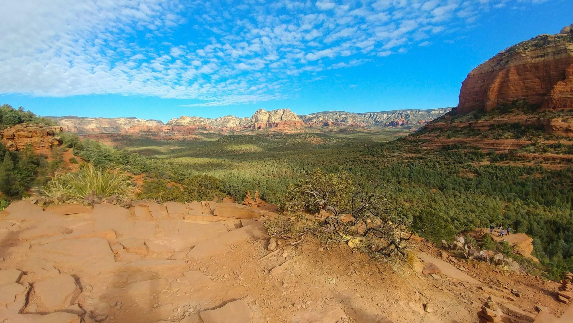
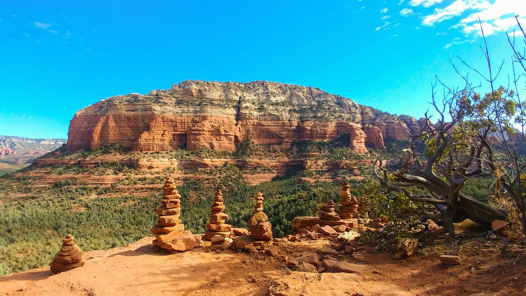
Once you reach the dirt parking lot at the Devil’s Bridge Trailhead the hike is .8 mile to the top. This section of the hike is where you start gaining elevation. Eventually you come to a fork in the trail. Heading toward the right leads to some stone steps as well as a section that involves a bit of a scramble to the top where you’ll get the most recognizable views of Devil’s Bridge. While we didn’t venture down the trail to the left, it leads to a view of Devil’s Bridge from the bottom.
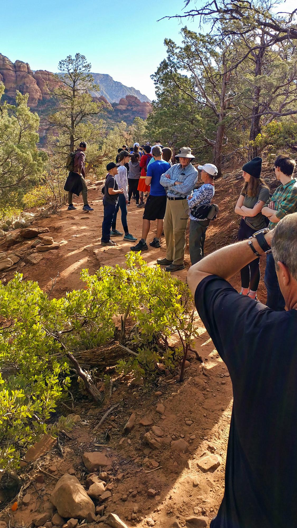
Even though we started our hike about 7:00 am we were surprised by the number of people already waiting their turn to view and snap their iconic social media photo op on top the bridge. We didn’t count the number of people waiting but the end of the line was around the corner where there was still no view of the bridge itself. Time moves a little slowly at this point but does provide an opportunity to rest your legs and catch your breath. This is also a great time to meet others in line and perhaps make arrangements to snap each others photos once it’s your turn. Most of the photos you see project a similar scene with nobody else in sight, but when you’re out there you’re usually looking back at a pretty sizeable crowd waiting their turn… unless of course you arrived for sunrise or sunset.


Be Careful:
As we slowly moved up toward the front of the line for our turn on the bridge we were shocked to see some of the careless, and down right crazy things people did. From standing and sitting so dangerously close to the edge and doing cartwheels to witnessing a young man with a baby strapped to his chest actually jump over the narrowest portion of the chasm. I don’t think we’ve heard such a loud collective gasp from the crowd. Please use good judgement and common sense up there.


Difficulty Level:
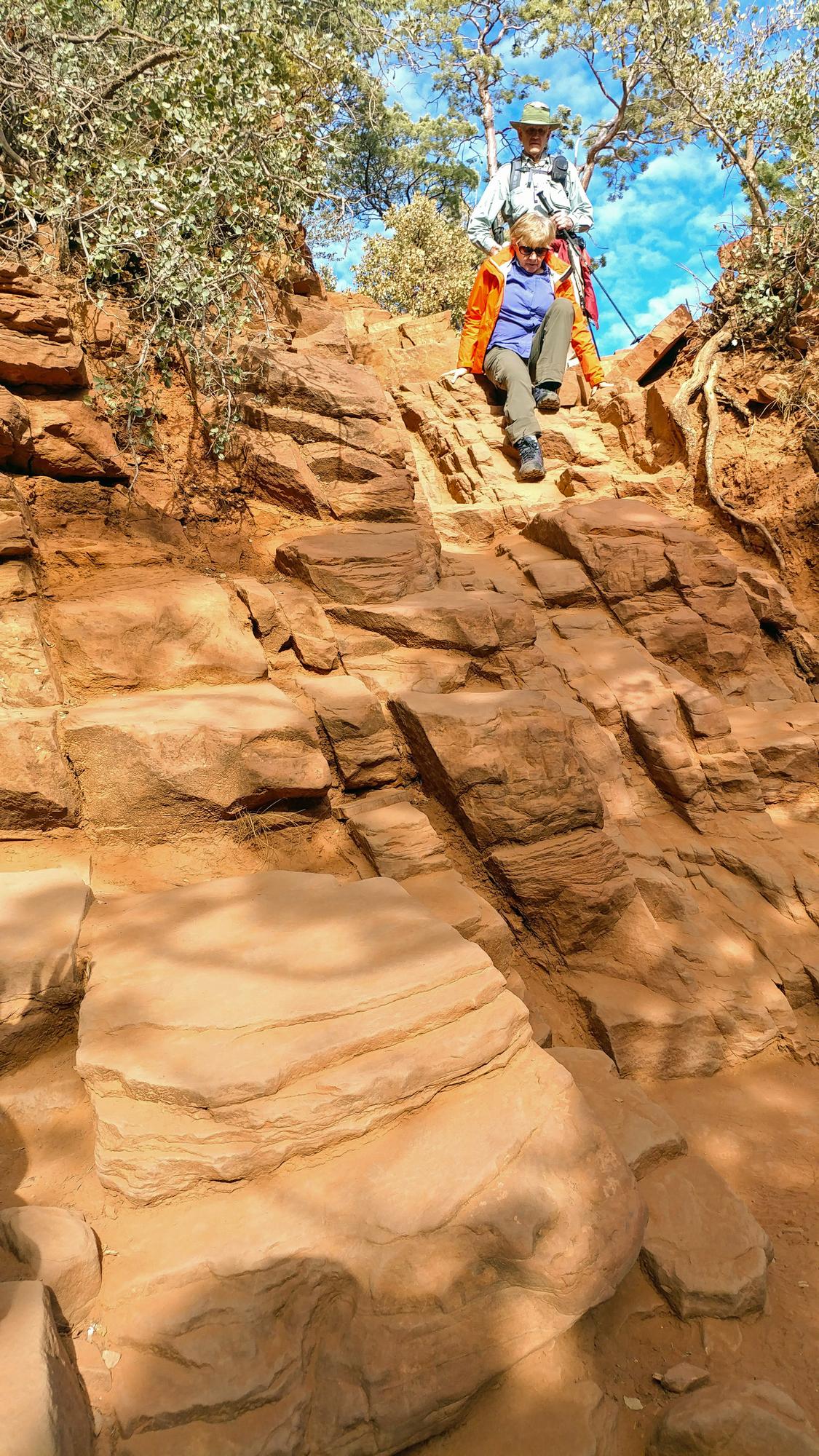
Most of the hike to Devil’s Bridge is pretty easy, though the section toward the end of the hike involves a moderate scramble to climb up to the Bridge level. To be honest we thought coming back down seemed a bit more precarious, so be sure to exercise caution during this portion of the hike. Here is a photo of a woman making her way back down this section.
Essentials:
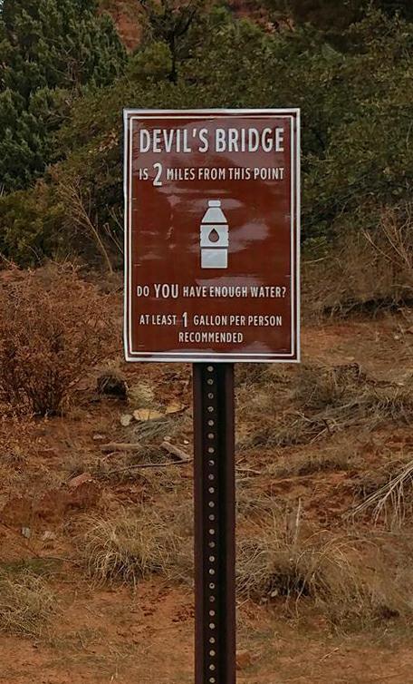 Sedona is a high desert and can get very hot. Be sure to wear sturdy hiking shoes/boots, a hat/sun protection and most importantly water. Signs at the start of Dry Creek Road state that this is a hot and dry hike and advise each person to carry at least one gallon of water. We were surprised to see people wearing flip flops and many with little to no water as we passed by them on our return hike. We should probably have had another liter with us because we were pretty parched when we got back to our car. So take heed! As we departed we were amazed to see how many more cars were parked along side the road in both directions, so do plan to arrive early.
Time To Recharge!
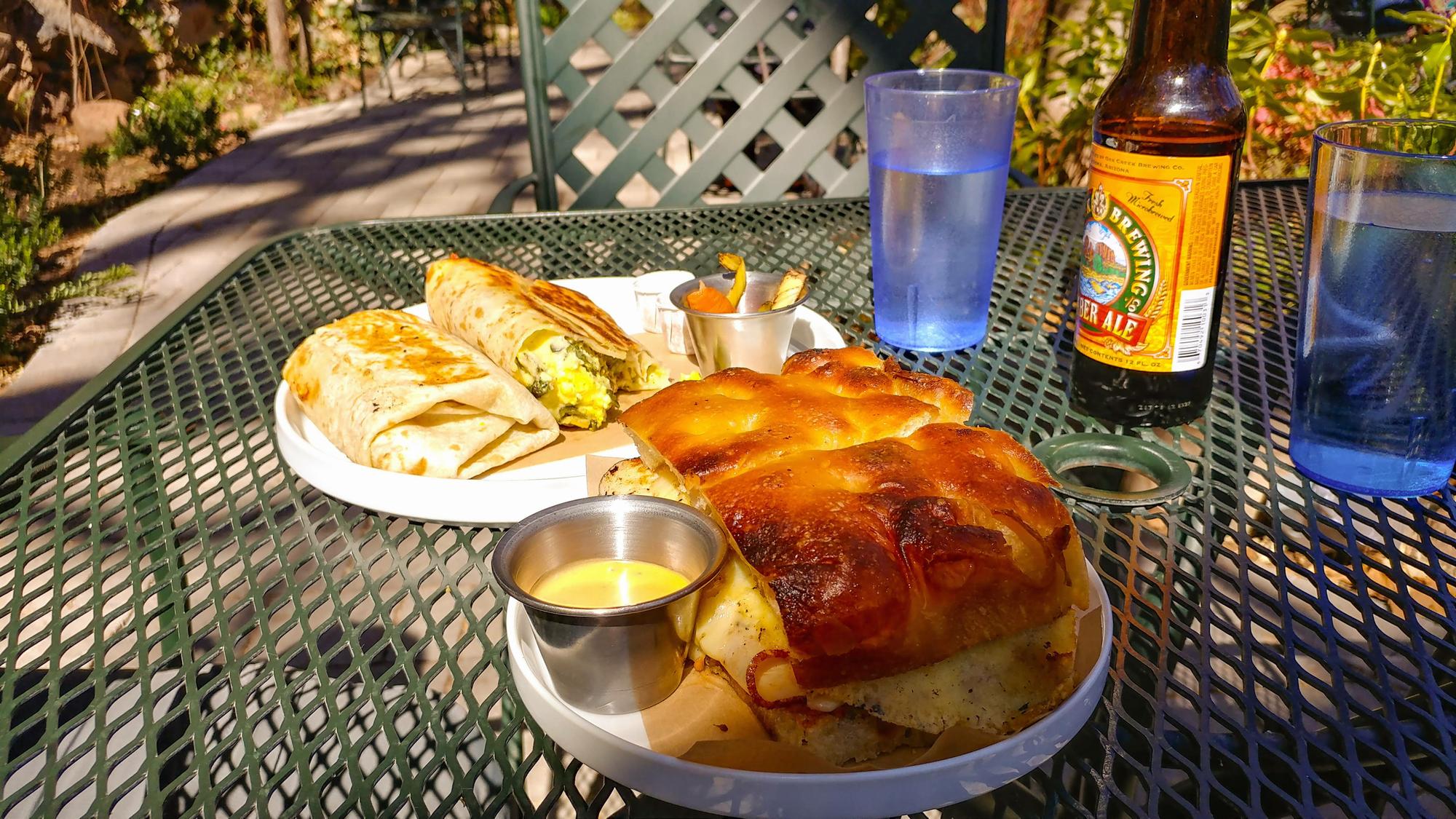
We worked up a good appetite on this hike and stopped in at the Indian Gardens Cafe. It’s located about 4 miles north of Sedona’s main shopping district and away from the hustle & bustle and yes, all that traffic! It had a great outdoor cafe area and proved to be a perfect spot to recharge!

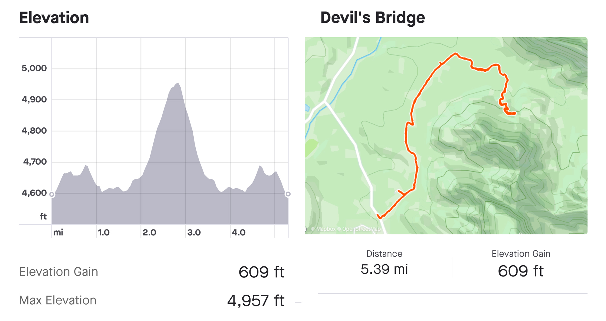
Our Hike Analysis From Boynton Road:
Map Coordinates:
Parking Lot: 34.89013, -111.82057
Devil’s Bridge 4×4 Lot and Trailhead: 34.90275, -111.81378
Mescal Trailhead: 34.90181, -111.82673
Devil’s Bridge: 34.89762, -111.80769
Click ![]() To Toggle Map Slider To Display Hike Options
To Toggle Map Slider To Display Hike Options